Counting and Measuring Cabbage Heads With Drones For Yield Estimates
January 17, 2024
Cabbage crops have a limited harvest window for growers to optimize head size, quality, and quantities to meet their buyer’s contracts. A premature harvest could reduce total yield undercutting potential revenue, but a late harvest could sacrifice quality or succumb to pest damage.
An unlimited number of environmental variables makes ideal harvest timing an annual quandary. But cabbage grower contracts rigidly dictate the deliverable size, quantity, quality, and date. Failing to meet these parameters risks revenue loss or, worse, contract forfeiture.
Traditionally, growers based harvest timing on visual observations or sample field measurements. But most growers would like a faster, more objective means of evaluating harvest readiness and head size. Plant Counts with size estimation from Solvi gives growers a simple protocol to automate the process.
A Cabbage Field Example
For three seasons, Solvi worked with agronomists from HIR Skåne and researchers at NIBIO, RISE, and Agroväst to count and measure cabbage for MOEK’s, a Swedish grower co-op, growers. The objective was to find out if size measurements done with drone imagery are comparable to actual sizes measured in the field, if such measurements can be translated to total yield (weight), and with what accuracy.
The overall goals of the project were to:
- Count plants in early growth stages to evaluate crop loss
- Measure mature head sizes against contract parameters
- Map head size distribution across an entire field
- Project potential field yield
Details
Partners: MOEK, HIR Skåne, RISE, NIBIO, Agroväst
Crops: White and red cabbage
Location: Skåne and Östergötaland, Sweden
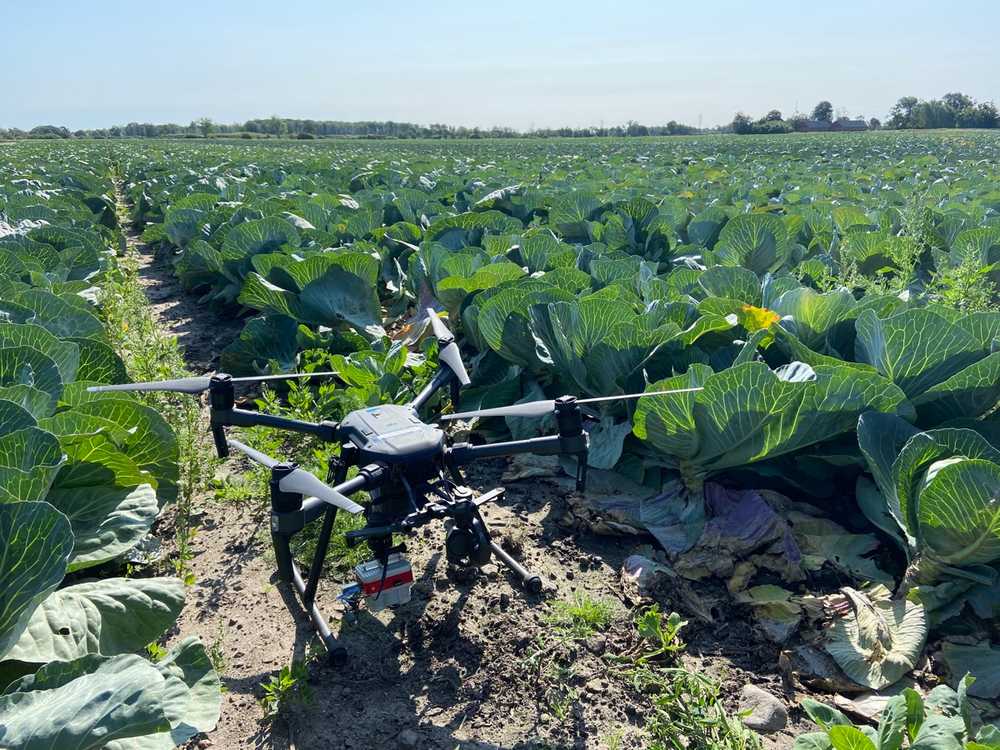
Hardware: DJI Matrice 210, DJI Zenmuse X4S, MicaSense Altum
Software: Solvi’s Plant Plant Counts & Size Estimations
Flight Altitude: 10-20 meters Above Ground Level
Number of flights: 3 per field per season
Image resolution: 0.2 - 0.5 cm/pixel
Field Methodology
Researchers collected drone imagery at three intervals each season:
- 3-4 weeks after planting - to count plants, assess crop establishment, and estimate early crop loss
- 11-13 weeks after planting - to evaluate plant health and assess pest/disease damage
- 2-3 weeks before harvest - to count heads, measure head diameter, and refine yield estimates
The data was collected in 2 regions - Southern (Skåne) and Eastern (Östra Götaland) Sweden. 3 new fields per season were selected in each region. The researchers have used a DJI X4S RGB camera as well as MicaSense Altum multispectral sensor.
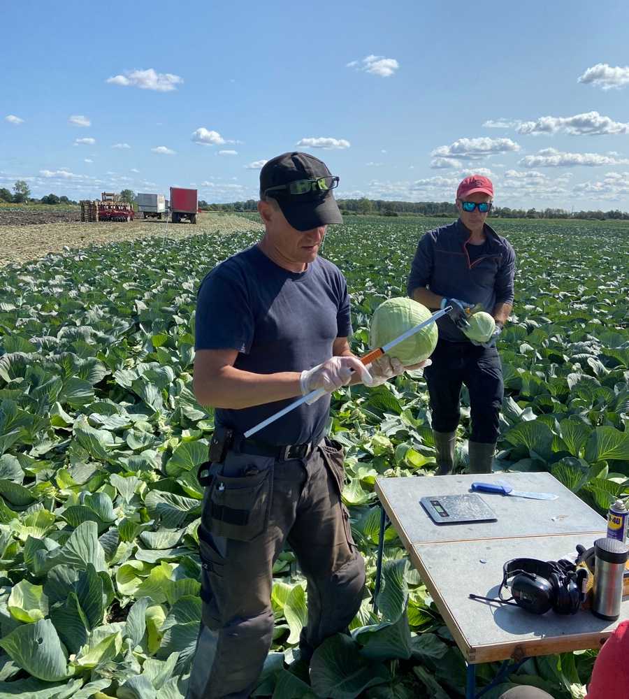
In each field, researchers have established 4 validation plots with about 200 cabbage plants per field in total. Plots were located in different parts of the field to take into account possible variations in soil type. During each data collection, manual counts and measurements were done in each of the plots.
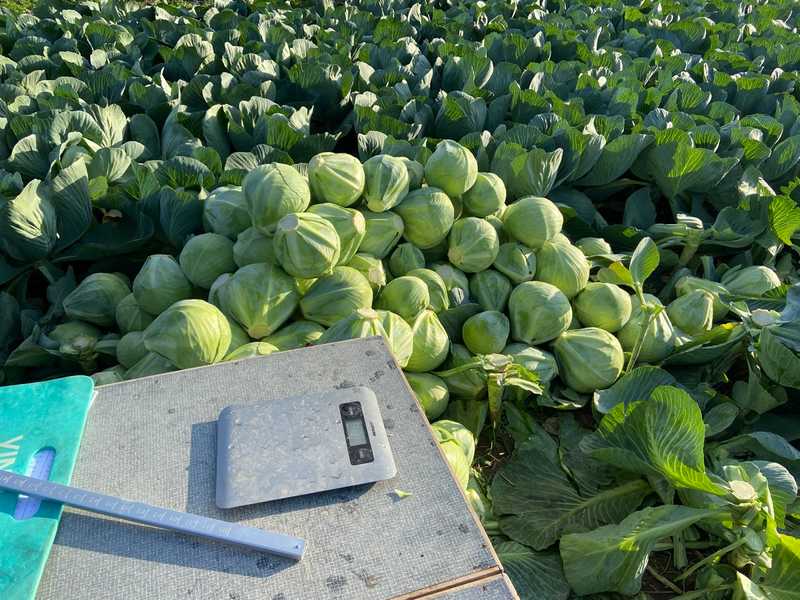
At harvest, all cabbage heads in the plots were harvested and measured manually and compared to the preharvest drone imagery. Researchers measured the diameter and weight of each harvested cabbage head and found a direct correlation between head diameter and harvested weight.
Cabbage Plant Count Insights
1. Starting Field Inventory (3-4 weeks post-planting)
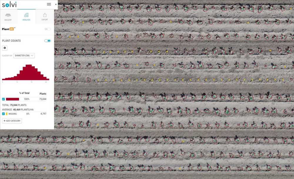
An initial plant count of each field provided a quick read on crop establishment and revealed areas of plant loss. Plants were counted at slightly different times after the planting to capture variability in plant size and density across the fields. Researchers have compared manual counts of about 2000 plants to the data generated from the drone imagery and could conclude a 99,2% accuracy of the automated approach.
In addition, skip counts allowed growers to quickly calculate a replant threshold and identify field areas with abnormal skips for future practice improvements.
2. Pre-Harvest Head Counts and Size Measurements (2-3 weeks before harvest)
Pre-harvest field data gauged crop maturity. Researchers finetuned Solvi’s PlantAI identification model on the shape and contour of sample cabbage heads in field images. Even at such a late growth stage, the researchers could achieve counting accuracy close to the counts in the early-stage stage.
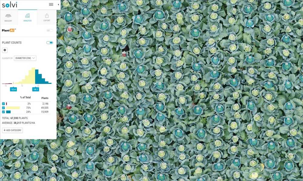
In addition, the Plant Counts tool provided an estimate of diameter for each cabbage head and grouped all size measurements into three visual categories giving growers an understanding of size distribution across the whole field.
3. Yield Projection
Comparing drone imagery and manual field data suggests that head size and weight are correlated for yield estimates. Researchers have plotted all manual measurements on a chart and, not surprisingly, found a good correlation between the diameter of each head and its weight. Thanks to the rich amount of measured data points, they could establish an average weight for each centimeter of diameter.
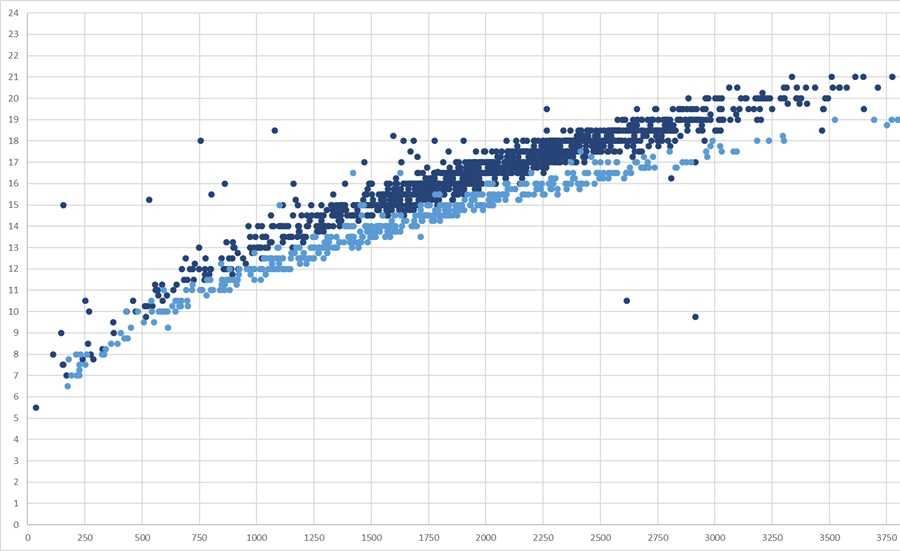
Researchers have then used these established averages to translate diameters measured from the imagery to total yield and compared the results to the actual weighted yield measured in the plots. While factors like imagery quality or cabbage heads covered by leaves and only partially visible affected the measurements, researchers could still ascertain 80-90% accuracy. For example, in one of the fields, the total actual weight of 175 cabbage heads was measured at 360 kg, and the weight measured from the drone images was 384 kg.
These full-field reports provided growers with a new level of precision data not practical on foot.
Advantages of Image-Based Plant Counting for Heading Crops
As a result of this 3-year project, by working closely with growers, researchers, and agronomists have identified several benefits of using drone imagery in cabbage production:
- Quantification of crop establishment for the entire field
- Geolocation of loss areas for direct scouting
- Head size measurements to guide harvest timing for the highest crop grade
- Yield projections to estimate harvest quantity and weight
- Significant time savings and accuracy improvement versus manual measurement
Objective Crop Management with Solvi’s Plant Counts
Solvi’s imagery analytics allows users to finally quantify what used to be best guesses. Management decisions can now be based on facts, not estimates. Precision agriculture just became doable.
- Complete all-in-one cloud-based platform.
- Flexible to work with any RGB or multispectral camera and drone combination.
- Simple four-step imagery upload process.
- Highly accurate plant counts and health analytics.
- Clear, visual plot boundary maps and data results for research reports.
- Easy online sharing for full team access.
- Streamlined data exporting for offline use or integration.
This collaborative project was funded by the EIP-Agri program, project number 2018-3798.

